Hongkong Exploring Ho Hok Shan, Yuen Long History
I'm going through all the posts on my old blog, seeing what is worth salvaging. Unfortunately, with hindsight, most of it was fairly uninteresting, however this one is worthy of keeping and may be of interest to any military buffs out there (HK has a lot - not surprising given its experience of the Japanese occupation). Actually, this trip was covered in much better detail by David Bellis over at Gwulo.com, but I figured I would add my two cents seeing as I tagged along for the ride as well.
I take no credit for finding this location � for that we have to thank Thomas who found what he thought were trenches circling the various contours of the hill. This suspicion was also echoed by Rob (a NZ-based ex-Hongkonger who spent much of his time in HK exploring and documenting a vast number of ex-military structures around HK and the NT) who had an old aerial photo the same hillside which showed lots of dark and rather squiggly lines all over the hillside. So off we all went.


The trenches continued up to and encircled the summit before following the ridge as it dropped down the northern slope of the hill. It was down here that we found another bunker. This time a much larger one that went right into the hillside. Here is an obscured view of its entrance.

Now, perhaps at this point I should explain the Gwulo pecking order. David, as webmaster and general instigator of these walks, sits at the top of a very small and flat pyramid. He was also the only one carrying a stick. It was therefore he who was nominated (in his absence I must add � because he had decided to quickly run back up to the summit to take some more camera snaps) to be the one to hop on down there and thrash about a bit to see what lay beyond the entrance.
Like a true trooper � and someone who also officially certified by the Govt to enter HK�s various tunnel systems � he jumped down there and swatted the foliage out of the way with his big stick. It turned out to be a long structure with small rooms leading off to the side. Despite his valiant efforts and his increasing understanding of why no one else bothers to bring their sticks with them (hehe ;-)), he was mobbed by some rather large bees and decided to evacuate. Still, it begs the question as to what this place was intended for. Again it was too short for anyone other than someone bent double and why so big. Was it for munitions, stores, or perhaps a simple hiding place? The mystery deepens.
Anyway with that we headed down hill through some rather dense jungle and hit the main road before heading back into town for some grub. In all it had been an interesting little excursion that confirmed the existence of the trench system but also threw out some questions as to why it was there and what the original purpose was.
Given the location of the hill - with sweeping views of the Yuen Long plain and beyond as far as Deep Bay, then it�s easy to assume the trenches and bunkers were created to keep an eye on the border zone. But how long had it been there? Was it pre- or post-war? Was it there for training or to keep an eye on invasions from the north? Sadly, unlike Ki Lun Shan which we now know was dug in 1951 by the British Army, we still have no idea who was responsible for this small trench system. So, if anyone knows anything feel free to get in touch and let us know more. And with that I shall leave you with some views from the top of the hill.


I take no credit for finding this location � for that we have to thank Thomas who found what he thought were trenches circling the various contours of the hill. This suspicion was also echoed by Rob (a NZ-based ex-Hongkonger who spent much of his time in HK exploring and documenting a vast number of ex-military structures around HK and the NT) who had an old aerial photo the same hillside which showed lots of dark and rather squiggly lines all over the hillside. So off we all went.

Ho Hok Shan is the hill seen centre-right
After meeting at Yuen Long West Rail, we made the 20 or so minute walk over to Au Tau village and Ho Hok Shan, the latter being our intended destination. Along the way we passed a (soon to be removed, no doubt) colonial post box as well as some old signposts to (now demolished) Govt buildings along Yau Shin Street and a village marker stone.
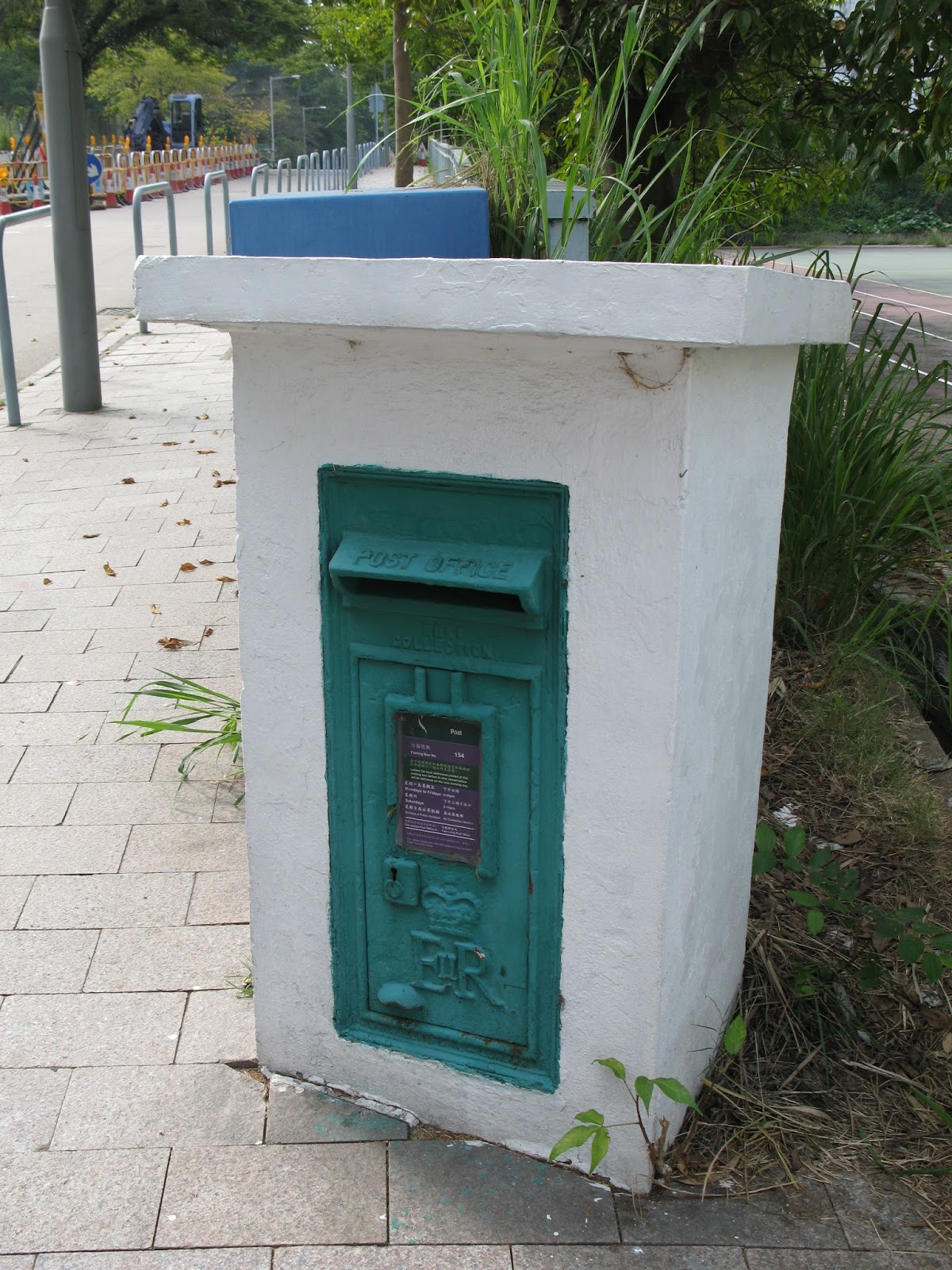
Elizabeth Regina II Postbox


The stone marker is obviously well maintained (it looked as though it had been recently given a new lick of paint) and the Chinese says 'Yeung Gai'. Yeung can be a Chinese surname and Gai actually means a boundary. The Chinese name for the New Territories (?? - San Gai) literally means 'new border'. So, perhaps this stone is telling us that it marks the edge of land owned by the Yeung family/clan?

Ho Hok Shan
Anyway, we started up the slope not far past this marker stone at the southern end of the hillside and it wasn�t long before we started to come across bundles of old and very rusted barbed wire. Some of it lying loose, some of it attached to metal bars stuck in the ground. We know from previous explorations of military remnants that not everything in HK is left over from the Japanese invasion, some of it was part of the preparations for post-war invasion by the People's Liberation Army. It seems that the Colonial Govt was quite paranoid about this to the extent that a large illegal kerosene smuggling operation at the end of 1950 was, in fact, initially thought to be the start of the invasion (this little snippet was garnered from Denis Bray's excellent and informative memoir Hong Kong Metamorphosis).
Anyway, the presence of rusty barbed wire meant that not too far away we would find some trenches, and so it turned out to be. They started a little further up the hill and were initially quite shallow � about a foot deep, useless for anything more than just crawling along � but got deeper and wider the higher we got up towards the summit of the hill (see an example of the shallower trenches here). Did the lower shallow trenches have some specific purpose? They didn't seem to be deep enough to accommodate anything other than a small person crawling along on their belly. Perhaps the ground on the lower slopes was too hard to dig into, or maybe whoever was responsible just ran out of time? Whatever the reason(s), these shallower trenches occupied most of the southern part of the hill's slopes and petered out on the lower southern peak where an electricity pylon now stands. The deeper and more substantial stuff was further north and higher up.
At various intervals the trenches splintered off in various directions and on a whim a few of us decided to follow one and see where it went. Good job we did because at the end we found our first bunker.


Now, as you can see from the shots above, perhaps the term �bunker� is a bit generous. These areas just seemed to be parts of the tunnel where the digging had stopped and a concrete lid was put on top, the insides were skimmed and then some stones piled on the lid to camouflage it a bit. Were these meant for storage or for shelter by humans? They seemed a bit small for soldiers and there was only one opening � unlike the observation posts we found on Ki Lun Shan a couple of year ago that had viewing slits under the lids.
Walking up the ridge line it was quite obvious where the trenches had been dug because they were sprouting vegetation that was a distinctly different colour to the surrounding vegetation. The reason is that water tends to collect in the holes, as you would expect, and as a result the plant growth tends to be more successful. An interesting sight on the hill�s summit seems to be a small altar. Actually, I�m not sure what it is but it does look as though it has lost its roof tiles.


The lower picture above shows us the view looking roughly north west with Yuen Long town centre in the background.
The trenches continued up to and encircled the summit before following the ridge as it dropped down the northern slope of the hill. It was down here that we found another bunker. This time a much larger one that went right into the hillside. Here is an obscured view of its entrance.

Now, perhaps at this point I should explain the Gwulo pecking order. David, as webmaster and general instigator of these walks, sits at the top of a very small and flat pyramid. He was also the only one carrying a stick. It was therefore he who was nominated (in his absence I must add � because he had decided to quickly run back up to the summit to take some more camera snaps) to be the one to hop on down there and thrash about a bit to see what lay beyond the entrance.
Like a true trooper � and someone who also officially certified by the Govt to enter HK�s various tunnel systems � he jumped down there and swatted the foliage out of the way with his big stick. It turned out to be a long structure with small rooms leading off to the side. Despite his valiant efforts and his increasing understanding of why no one else bothers to bring their sticks with them (hehe ;-)), he was mobbed by some rather large bees and decided to evacuate. Still, it begs the question as to what this place was intended for. Again it was too short for anyone other than someone bent double and why so big. Was it for munitions, stores, or perhaps a simple hiding place? The mystery deepens.
Anyway with that we headed down hill through some rather dense jungle and hit the main road before heading back into town for some grub. In all it had been an interesting little excursion that confirmed the existence of the trench system but also threw out some questions as to why it was there and what the original purpose was.
Given the location of the hill - with sweeping views of the Yuen Long plain and beyond as far as Deep Bay, then it�s easy to assume the trenches and bunkers were created to keep an eye on the border zone. But how long had it been there? Was it pre- or post-war? Was it there for training or to keep an eye on invasions from the north? Sadly, unlike Ki Lun Shan which we now know was dug in 1951 by the British Army, we still have no idea who was responsible for this small trench system. So, if anyone knows anything feel free to get in touch and let us know more. And with that I shall leave you with some views from the top of the hill.


