The Ping Shan Heritage Trail is the better of two official 'heritage' trails in the New Territories. Compared to Lung Yeuk Tau in Fanling (the other trail) it is easier reach and navigate, better organised, better maintained and has some quite unique sites of interest at both ends. If you are pushed for time and are weighing up a trip to Ping Shan or Lung Yeuk Tau then I wholeheartedly recommend Ping Shan.
The trail is actually quite short, probably less than 1km, but the fact that there is lots to see means to can spend some meaningful time exploring what there is to see rather than tramping around between sites getting lost. At one end of the trail is the Tsui Shing Lau pagoda � one of HK�s oldest man-made structures (if not the oldest) � and at the other is the excellently restored and maintained Ping Shan Police Station, now operating as a museum for the local area�s history and culture. More on the police station later because we started our visit at the pagoda end.

The best way to reach the trail is the MTR West Rail. The famous pagoda sits right outside the entrance of Tin Shui Wai station. In a way it�s a bit sad because photos taken not that long ago � before the West Rail project was started � show the pagoda standing in an idyllic position surrounded by rice paddies and green fields. However, as with most places in HK, time has taken its toll and the pagoda is now surrounded by the marks of modern NT life (also known as the 4 C�s): Concrete, Car parks, Corrugated iron and Containers (of the shipping kind).
Anyway, back to the pagoda. It�s astonishing to think this place is 600 years old. Most buildings in HK last less than 50! Tsui Shing Lau (The Pagoda of Gathering Stars) was originally several stories higher but according to the local Tang clan � whose ancestors built it � various natural elements have conspired to reduce its size. It could have been either lightning strikes or typhoons depending on what you read. When the pagoda was shortened is a matter for some debate. Perusing various sources has simply revealed (when you read between the lines) that no one actually knows. This implies (to me at least) that it is beyond written history and it seems that even the village elders don't know. There was a recent discussion over on
Gwulo.com where a reader had posted a 1948 picture of what she thought was the pagoda showing what looks to be more stories, but to anyone with familiarity of the area can easily see this is not Ping Shan, despite valiant (and misguided) attempts to prove otherwise. Plus the fact that there are documented pictures taken in 1937 showing the pagoda was already 3 stories.
Still, it�s an impressive sight to behold and a good start to the trail. You can�t ascend the pagoda but the door does open (when the attendant isn�t eating lunch) and inside is a small display including some information about the pagoda as well as the official Govt literature about the trail.

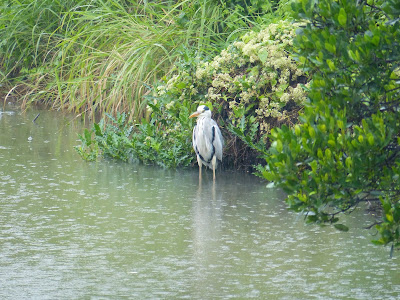
Don�t walk through the village from here. You need to skirt around the outside of some sort of car park/concreted industrial space to make your way to the next stop which is a very large Earth God Shrine. On the way you�ll pass a large fish pond � quite nicely landscaped � and our next stop is just a short way down.
Earth Shrines are a common sight all over the NT and almost invariably have a rock in the middle of a usually small altar to allow the villagers to worship the earth god a.k.a To Dei Gung. The Earth God is responsible for protecting the area and villagers to which he belongs (I say �he� because he is invariably depicted as a man in drawings � usually carry a staff and a gold bar shaped like a small boat). Actually there are shrines everywhere in HK, Earth God Shrines, Tree God Shrines (usually underneath a Banyan tree) Well God Shrines etc

The Ping Shan Earth God Shrine here protects Sheung Cheung Wai, the nearby walled village, and is actually fairly large. If you have ever visited Tsang Tai Uk in Tai Wai you may recognise the shape of the altar sides. Commonly known as Wok-Yee because they look like Wok handles they can be found in a few places in HK including Tsang Tai Uk where they form the roof baffles. Standing next to the altar is a furnace (for lighting incense and burning paper offerings) with a moulded dragon curled around the top. It looks quite intriguing and is not something I have seen before. I�m not sure if it has any greater meaning other than being a nice addition to an otherwise simple and commonly found structure.


The trail leads past the entrance of Sheung Cheung Wai. Now, despite the fact that there was a large notice in red on the outside of the villages gatehouse which basically said that it didn�t really want tourists (local and otherwise) tramping through there, the place was still filled with people taking snaps, so I�ll leave it to your discretion. You can see the sign just above the guys head in the snap below. It is in Chinese so if you don�t read Chinese then I guess you can plead ignorance :-)

Next stop we move to the old well. Wells were common place all over the territory, and in fact some very ancient ones were found recently when engineers were clearing a site for the Shatin-Central link. Given the seemingly increasingly poor quality of the water supplied to HK from China - it wouldn't surprise me if someone made a call to reopen all the old wells!

Just up on small slope behind the well is our first temple. It�s called the Yeung Hau Temple and its main deity is Hau Wong with two side deities: Kam Fa (patron saint of pregnant women) and To Dei (same dude who occupies the Earth God shrine � I wonder if the altar down the road is more of a pied-a-terre?). It's a common to have a temple dedicated to more than one deity, it's not surprising given the number of gods in Chinese folklore.


Next on the trail we come to what is, arguably, the centrepiece(s) of the village: two ancestral halls sited side by side and related to the two sides of the Tang Clan who live here.
On the left is the
Tang Si Chung Hall and on the right is the
Yu Kiu Clan Hall. The Tang Si Chung is supposedly 700 years old and built by someone called Tang Fung Shun. The Yu Kiu Hall was built much later (sometime in the 16th century). Both halls are very similar but I get the feeling that the older hall is slightly larger and a bit more grand inside which may or may not be related to the relative status of the two branches of the Tang Clan.
My cultural knowledge is sadly lacking when it comes to the NT rural history and so I can�t really do these places much justice in terms of explaining what they are all about other than they are a place where the clan�s ancestors are worshipped and also where much of the official clan business and festivities take place.
In China�s recent Imperial past, one of the aspects that affected such a remote area was the participation of village members in the Imperial Examination system. Just passing even the lowest level examination bestowed an enormous amount of influence on the clan member and general status of his clan (because it was always a 'he'). In fact, so sought after was the honour of the examination awards that various levels could be bought by someone with enough money � and it seems that in terms of the influence they bestowed there doesn�t seem to have been much difference between those earned via scholarly means and those simply paid for. Both these halls contain plaques commemorating the achievements of various village scholars in the Imperial Examinations. My Chinese Imperial Examination knowledge is a bit scratchy but I believe the following two plaques indicate that someone in the clan had passed the Examinations at the highest level. The first two of the central line of vertical characters (??) say Han Lin (in Canto it would be
Hon Lam) which was the name given to someone who was successful in passing the
Chao Kao imperial exam. I understand this was the highest level attainable (but I would also like to hear from anyone who can correct or concur with me).
Why the plaques are different I don�t know but you may be able to see both plaques say the same thing, it�s just that one is brown and one has been embellished with some nice stylised clouds.
Each hall has its ancestral tablets on display in the main altar at the back. As seen in the picture below. The two characters either side of the altar below are standard characters for two important Confucian principles. On the left we have ? (
dai) which represents fraternal love and on the right we have ? (
hau) which means filial piety � two principles that still show a strong influence even in modern HK society.
Inside the ancestral hall
Aside from the internally displayed plaques, scholastic achievements are also commemorated on the outside of each hall with the addition of so-called 'scholar stones' - basically upright slabs of stone erected in front of the hall and capable of supporting flag poles. Any lowly passerby (such as one of the clans land tenants) was expected to show respect by bowing to the banners flapping above the stones.
Not grave stones...scholar stones
Directly in front of the halls is the village square and beyond that a�carpark. Yes, one of the great C�s rears its head here. What used to be a picturesque series of 'Fung Shui' ponds have been turned into a concreted stretch of ground for lorry drivers to park their trucks. I guess fung shui has practical limits for some people and the fear of upsetting the fine spiritual balance of the area was far outweighed by the chance to earn some extra dosh by charging an hourly parking fee. Such is life these days in the New Territories. It's a situation repeated almost everywhere, sadly.
But anyway, next on the agenda is the Kun Ting Study Hall. Both this place and the neighbouring Ching Shu Hin Guest House were until recently victims of a dispute between the Tang clan elders and the Govt. The dispute concerned a Govt landfill site and the clan graves that had to be re-sited as a result. The local Tang clan weren't at all happy and for several years the buildings were closed to visitors. If you visited the trail at this time then you were an unwitting victim of Govt and village politics that actually goes all the way back to the annexation of the New Territories by the Colonial British Govt in 1898/1899. Thankfully, things seem to have been smoothed over (for the time being) and we can now have a quick look inside, however, there still seem to be some buildings closed to the public, so perhaps not everything has been resolved?


Study Halls can be found all over the NT and usually had two purposes. The first purpose was to prepare clan members for the imperial examinations and secondly, to impart status on the clan. Any clan that could afford to build a study hall (as opposed to using the ancestral hall for the same purpose) was one that was rich and powerful. After I originally posted this article, David Leffman - the author of various Rough Guides covering China and Hong Kong - told me...
at least two examination halls survive on the mainland, at Langzhong (??) in Sichuan and Jianshui (??) in Yunnan. These aren�t the study halls as at Ping Shan, but were where candidates actually sat their local examinations. Success in these qualified them to take the Imperial Exams in Beijing, to become government officials. The system was abolished in 1905.
The guest house immediately adjoins the study hall, but there is a nice gap between the buildings which would probably have been a thoroughfare before development sealed off the end? Check out the circular
quernstones on the floor. These were used for grinding rice into flour.
Entrance to the guest house
There�s a nice informative bi-lingual display inside the guest house to complement its interesting architecture and it�s well worth spending some time here reading all the information as well as the aerial pics which track the development of the whole area. The guest house marks the end of the trail's village sites, but it is worth continuing up the nearby hill to the Ping Shan Police Station. It's one of the finest looking buildings in the area and it has been well restored and turned into the local museum.
Ping Shan Police Station - now an excellent local museum
The museum exhibits cover all sorts of things about the local area and the Tang clan and the building itself is great to look at and provides a great view around the whole area. The reason for the great view is its former use as a Police Station and the need to keep an eye on a large swathe of the surrounding countryside. Like other official structures built at the beginning of the NT lease, this one annoyed the locals by being built on the highest point and thus (supposedly) affected the fung shui of the surrounding area. It's a shame they don't use the same argument to prevent lots of unsightly shipping containers and car parks being constructed, but I guess the villagers never made any money from the Police Station ;-).


