Traveling along the Tai Po Road can be quite fun - even when at the whim of HK's notoriously poor minibus drivers. The road has a fair amount of history linked to the original leasing of the New Territories to the British Colonial authorities, and as such has character with its long curving route and often agreeable vantage point over the surrounding scenery. Although parts of it have changed in the intervening years - through either some straightening or just replacement by faster (and more boring) highway, there are still stretches of it that are true to the original road and I always figured it would be interesting to walk it for a change. So, a year or so ago when I finally got my youngest off to kindergarten, I found the time to walk the section from Tai Po to Fo Tan.
This section of road, the last to be built of the original route, is about 5 miles in length and is reasonably true its original path to about 90%. There are a couple of minor deviations which I will talk about when I get there. I did this walk on a typical hot sweltering HK day at a steady stroll (stopping for photographs) in about 2 hours. I didn�t find too many relics, but there was enough to see to keep someone like me happy (though I am easily pleased) and of course it�s just a very nice way to see this part of the NT.
I started the walk from the far end of Kwong Fuk Road in Tai Po, next to the Lam Tsuen River and the Kwong Fuk Bridge. Don�t be fooled by the road name, it may now be called Kwong Fuk Road, but it was originally the final stretch of the original Tai Po Road which terminated at the river crossing. As mentioned, the original Tai Po Road was built soon after the NT was ceded to the British in 1898. At the time, the river crossing was a mere footbridge, allowing people to cross to and from the new market on Fu Shin Street, so it�s really no surprise that the road terminated here.
It wasn't until later on - probably spurred on by the appearance of motor vehicles - that the road was extended to Fanling and beyond and the bridge enhanced to cope with ever increasing amounts of traffic. When Tai Po became a �New Town� in the 1970s, vehicular traffic was routed over newly reclaimed land, the vehicular bridge over the river was dismantled and replaced, once again, by the smaller pedestrian version that we can see today.
Anyway, it seemed appropriate to start the walk at the same place where the road originally terminated.
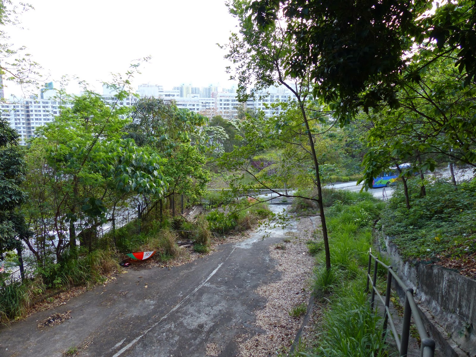
Looking down Kwong Fuk Road (Tai Po Road)
from its original end-point
Well, now that�s sorted, off we go leaving the shade of the trees along the riverside and head down Kwong Fuk Road. Despite the age of the streets around here (see this
blog post for a more detailed look) the oldest buildings in the immediate vicinity date back only as far as 1956 � a relatively long time for any building in HK. Numbered 1 � 19 Kwong Fuk Road, these
Tong Lau (lit: Chinese tenement buildings) have seen a lot of action and are in need of some love and attention but are nicely designed with some streamlined curves and stylish lines on the light-/stair-wells. Here is a shot I took a few years back seen from the opposite side of the road.
When these buildings were completed, the land they are sitting on had only just been reclaimed from the nearby harbour.
The air/light well seen from the ground
The stairwells and their nicely curved walls
Further down, our first junction is with On Fu Rd. This road was created specifically to provide vehicular access to the old train station. The station was decommissioned in 1983 but even today the street still abruptly ends at its gated vehicular entrance. Of course, these days its use as the
HK Railway Museum mean that cars no longer drive up here.
On Fu Road � access to the station dead ahead
The next junction is with Po Heung Street. This road demarcates the older part of Tai Po Market from the newer and is the road that was used to route the traffic away from the former Kwong Fuk Bridge. Pretty much everything in front of us was built between the 60's and 70's including the Plover Cove resettlement estate that sits on our left.
Red/white colours of the Plover Cove Resettlement Estate
Whilst we are walking along this part of Kwong Fuk Road it�s worth bearing in mind that the original road was built on a causeway rising out of the seabed. Essentially we are straddling what used to be the original coastline and the road causeway ran the whole length of this part of town all the way down to Island House (a distance of about 1 mile). Even up to the 1950's there was very little development here and we would have had an unbroken view over to the Old District Office (North) on top of nearby Flagstaff Hill (so called because it was the location of the official NT handover ceremony in 1899).
The view to Flagstaff Hill is now well and truly blocked
As we approach Tung Cheong Street you will pass a veritable Tai Po institution: the �Bobby London Inn�. A bizarrely decorated faux half-timbered exterior conceals a drinking establishment within. Now, I can�t give any personal recommendations because I haven�t ventured in since 1996, but back then you could get a decent pint and a seat to park your bum. I did my growing up in a town (Coventry) where a night in the pub could easily be your last night on earth - or at least the last night with your original face - so sitting down for a quiet drink without getting into a life threatening brawl is always refreshing experience.
Before this area - originally called Ap Mo Liu - was redeveloped it was the location of a fish market. Close proximity to the shoreline meant it was the ideal place for local fishermen to bring their fresh catch. The fish market has long gone, but the area contains some more antique(ish) buildings including this place � collectively known as 157-163 Kwong Fuk Road.
It�s a 1950's (built circa 1952, I believe) low-rise residential block that has quite a bit of character � wide open balconies, and what looks like cantilevered fronts extending over the pavement. It�s prime location provides a great place for local politicians to put their advertising (in this case good old Ronny Tong).
This building also has an interesting relic stuck to the front of it � an old T-shape street sign.
These older T-shaped signs are rare and are hard to find, so the fact that Tai Po also has its very own antique road sign is pretty cool. Modern signs are flat and flush and read L-R in both English and Chinese. These older ones were in relief and the Chinese read from R-L.
This one is also noteworthy because it has an alternative (older) romanisation of the character ?. Previously this was written as
Fook as you can see, but these days it is far more common to see it written as
Fuk - much to the amusement of English speakers everywhere
. Actually, I personally feel the double �O� is a closer approximation of the proper Cantonese pronunciation, but that's just my opinion of course.
This character (?) has a special meaning for this part of Tai Po as well because just down the road from here on what was the causeway to Island House was a large shanty village built on
stilts over the water. The predominant makeup of this small village was fishermen from Fujian (??) province, and their extended families. Fujianese descendents have been fishing HK waters for a long time and, as such, there are several places around the territory that bear references to them, including the road we are on.
Anyway, next door to this building is another interesting one that is a bit of an enigma. It's called
Man Sze Cheung Yuen and is a stylish curved, detached house with balconies and a huge attached walled garden. The place is immense by HK-standards and the land it's on would be worth a bundle, even out here in Tai Po. It was built circa 1955, according to records, but I have rarely seen anyone coming in or out despite it being obvious that someone lives there. You can catch a sneaky peek inside the garden if you ride the top deck of a passing bus.
Looking over to the other side of the road right now and you should be able to see a small corner of the
Old Tai Po Police Station poking through the trees.
The Old Police Station peeking through the green
This place is currently under renovation (more specifically �adaptive reuse� in Govt-speak) and this was supposed to have already started in 2012, but actually only commenced in late 2013. I was lucky enough to see inside once during a local historical tour and will post photos from that in a later post, but currently the whole hillside is under tarpaulin and many of the trees you see in the above photo have, sadly, been removed (remember, this photo is from 2012 and this is a re-post from my old Wordpress blog). An interesting thing to note if you are a birdwatcher is that during the early summer months, the tree tops surrounding the Old Police Station are filled with roosting egrets fixing up their nests.
As we look up at the Police Station, we are also walking past the old Tai Po Bungalow and Groom�s Cottage at 173 and 175 Kwong Fuk Road.
Groom�s Cottage
Tai Po Bungalow
Originally an accommodation for senior police officers stationed over the road and part of the same residence, they are now used by the A.F.C.D (that�s Agriculture, Fisheries and Conservation Dept) and the Norwegian International School respectively.
The bungalow used to have a signpost outside with its address saying something along the lines of �Tai Po Bungalow, 16 Mile Stone, Tai Po�. Someone did offer to show me around the bungalow once, but nothing ever came of it, so sadly I still don't have any closer pictures.
When I first posted this blog-entry I noted the remnants of what looked like the old milestone sitting in the grass. I was later informed that this wasn't the case, however, this stone is still there and is the right shape for it to be a milestone, so I'm not entirely convinced otherwise...yet :-). Here's a reminder...
Notice the grey stone just to the left of the railing?
No discernible markings but a distinctive milestone shape
Anyway, moving on past this point and the original road path gets confused because the whole area was reclaimed and the road rebuilt somewhat. What was once a dead-straight causeway reaching from here to
Island House, is now a large multi-lane road that acts as the main conduit into Tai Po from several areas. It�s messy to say the least but we can still walk it via some annoying pedestrian subways that make getting from a A to B a bit more like getting from A to Z via M, Q and T. The car is King in HK and poor little walkers, like you and me, have to settle for what often seems to be after-thoughts in urban design. Often the quickest way for pedestrians in HK to get to their desired destination is to go to their nearest car dealer, buy a car and then drive there instead :-/
Well, rant over and several subways later, we find ourselves where the old Fujianese shanty town was located. The villagers were rehoused into Kwong Fuk Govt Housing Estate during the 1980's and the whole area was, as mentioned, reclaimed. The �trickle� that was formerly the Tai Po river has been �
nullah-fied� and now looks like this.
Tai Po River
Being an estuary, the water you can see above is actually sea water and rises/lowers with the tide everyday. The freshwater that used to form the older, natural, water course now empties into the nullah further upstream (behind the camera).
On the north side of the road from here is the Kwong Fuk Estate. Courtesy of their harbour-side location, these Govt housing blocks have some of the best views in Tai Po as well as close proximity to the popular (and impressive) Tai Po Waterfront Park. I used to have a friend who lived here on the 20th Floor and the view was pretty amazing.
Kwong Fuk Estate
Just past the estate is where the Tai Po Road now makes an easterly curve to take us past Island House on Yuen Chau Tsai (before reclamation, the island was connected to the road by an even smaller causeway) and up into the surrounding hillsides. Originally the road had a level-crossing where it passed through the railtrack, but changes over the years mean that the road is now carried up and over the track via a flyover. I don't know for certain but suspect this flyover came into being as part of the electrification upgrade in 1983. It was too dangerous to have the track open to cars and people once the system was electrified.
Over the flyover towards Wong Yi Au
The first port of call on this stretch of the road is a village called Wong Yi Au where the
Zonta White House is located (in fact it�s hidden behind the trees in the photo below) but before we get there we cross over the railtrack. I'll try to visit the White House in a later post but for the time being I can tell you it is the former official home of the Assistant District Officer - the District Officer proper used to live in Island House.
The railtrack is actually a similar age to the Tai Po Road both being laid during the first few years of the turn of the last century. If you look at the Govt archive photo below, not only you will see the old shanty town along the causeway, but you can also see where the track used to cross the road as well as the White House centre left.
Source: HK Govt Archive
Other than the White House, Wong Yi Au is just another, very typical, New Territories village � lots of three-storey houses and barking dogs � so we keep walking and here the road starts to slope a bit as we head into the higher ground. The only thing to see here is the nice view over the town and of course across the harbour to the other side of Tai Po.
Wong Yi Au entrance gate
Looking back towards Taipo
Looking across Tolo Harbour
On that last photo you can see part the roof of the KCR (now MTRC) accommodation block that was built on the site of the former
Tai Po (later named Tai Po Kau) railway station.
It�s not long before we are well into the hillsides above Tai Po and seeing the road pretty much as it has been for many years � curvy and green.
Tai Po hills poking above the treetops
One thing I found a bit quirky was the way the hydrants have been stuck right on top of exposed pipework here. The reason? Perhaps the standard hydrants weren�t tall enough to avoid the crash barriers and so they extended the pipes? I don�t know. Anyway, quite bizarre.
Although the road still sees a lot of traffic, it is still relatively quiet compared to some HK roads and I guess there is an appeal here for those with the means (i.e. very rich) to buy one of the very nice and expensive houses that line the side of the road. There are some really nice properties up here � both standalone and part of small gated estates. The cost of living in this part of the world though would make most peoples� toes curl.
Got HK$200 million to spare?
There are small roads that lead off from here all over the place and pretty much all of them lead to some very exclusive and extremely expensive housing. I have no idea what these nice residences have replaced but most likely smaller village clusters and just empty land that has been bought up by developers and redeveloped.
Officially we are now entering what is known as
Tai Po Kau. It�s an area that is quite popular with hikers because of the various colour-coded trails that have been set up in the local Nature Reserve (we�ll get to the entrance soon), and also because of the aforementioned former train station. However, it�s also an area that has a rather less-salubrious past because it was around here in a banana grove that the body of Mr
Jalil Ibrahim � a bank auditor and one of the victims of the Carrian Group scandal � was found. There are still banana groves dotted around here but I�m not sure where this particular location was (news reports are sketchy on details) but it�s quite possible it has since been redeveloped to make way for our first major glitzy apartment complex called
Constellation Cove.
Constellation Cove was built by the Kerry Group (owned by the Malaysian Kuok family who also own the Shangri-La Hotel Group and the SCMP) and sits behind a rather large ornate lake called Kerry Lake. The area also houses the
Lake Egret Nature Park (formerly the Kerry Lake Egret Park) as well as the Museum of Ethnology inside a rather grand lakeside building (see below). It�s worth a trip if you fancy killing a couple of hours one Sunday. I believe the nature park was installed as a condition of the land sale and there are boats to rent for a nice easy row around the lake.
Kerry Lake � Tai Po Road runs along the hill behind this building
Further along, and we are now nearing the site of an unfortunate incident that I shall cover in a later post. Just around the corner from Constellation Cove is a small garden that sits at the entrance to the Tai Po Kau Nature reserve. It's a small road with a barrier gate that leads up to the start of the various colour-coded trails around the reserve. Well worth doing one or two if you have time one day. The small park area - more of a garden really - in front of the entrance to the reserve is called Chung Tsai Yuen (
???). If you fancy making the trip to the nature reserve one day, then the easiest is to catch a bus and get off at this stop of the same name.
Inside the small park is what I originally believed was a commemorative stone tablet, remembering a terrible accident involving a school outing and a flash flood in 1955. I'll repost my original blog entry about it at a later date but one of the outcomes of that original blog post was that the tablet was revealed (by a helpful commentator) to be a warning and not a commemoration.
Stone tablet at the far side of the park, centre right
Moving on up the road a short hop and we come to a small bus stop and what I believe to be the entrance to Tau Po Kau village proper. Next to the bus stop is one of those very typical communal postbox walls, containing all the mail slots for the village houses and just next door to that is what looks to be an old and dilapidated concrete box with what looks to be a posting slot on the front. See below. Is it an old posting box or something else, I can't tell.


Anyway, moving on a bit further down and we have one of my favourite little spots in HK � Tai Po Kau Park. I used to pop in here for the odd quiet hour or so when one of my kids was doing swimming lessons at a nearby school pool. It was always utterly deserted and one of the most peaceful and people free places in HK. Well worth a trip here for those needing some time away from the hustle and bustle. It has various little benches and small plant surrounded pathways as well as some open space at the far end and a great view over Tolo Harbour.
Continue walking along the road and the next point of interest is Yau King Lane - with a small lane called The Lookout Link running off it. Here you can find a heritage building called the
Tai Po Lookout. Sitting on what used to be a headland (before everything around it was filled in) with views directly down the Tolo Channel is the former residence of Denis Bray � a well-known local Govt officer � sadly now deceased. His memoir,
HK Metamorphosis, is well worth getting hold of.
These days the area around here has some protection from development, but in reality the Govt lacks the teeth to enforce these rules. You can put up all the signs you want telling people to be good, but in reality people will just do what they want, sadly.
Passing Lookout Link we are now getting into an area of the road that I know for certain has been changed. This is the area where St Christopher�s Home � an Anglican Church orphanage � was found and if you have been a reader of my blog anytime over the last couple of years you will be aware of the mystery of the
Olson land.
Approaching the Japanese International School
Instead of the children�s home we now have Deerhill Bay � thanks to Li Ka Shing and his never-ending quest to cover HK with concrete and overpriced apartment buildings. If you read the post I just linked to above, you will now know that the Olson land was resumed by the Govt so it could be leveled and allow the straightening of the Tai Po Road. On the site of the old land are now three schools and the only indication of what was once the Olson plot is a mound on the left hand side of the road and obvious marks on the opposite side where the rock and earth was excavated.
In the above snap we are looking into the Japanese International School's carpark. It's an odd shot to put up but I just wanted to show where the old route of the Tai Po Road went before being moved to its present, less deadly hairpin-like routing. Yes, before the school was built here, the old Tai Po Road went that way.
The picture above shows - on the opposite side of the road - the embankment formed when the Olson plot was excavated to allow the new road routing. It's greened a little but the bare rock can still be seen from the excavation work.
The shot-creted slope above is the other side of that excavation, and is part of the sole remaining parcel of land that was donated to the Anglican Church by the Olson family.
Anyway, moving on and it takes a few minutes to bypass Deerhill Bay due to its length, but once we have there are a couple of roads leading to villages that are part of the so-called Alliance of 7 (The
Tsat Yeuk who were responsible for setting up Tai Po New Market, I wrote a little bit about them
here). Cheung Shue Tan and Tai Po Mei villages are both part of the
Tsat Yeuk, despite being all the way over here, halfway to Shatin. This geographical fact reveals how important Tai Po Market was to the whole area - people would come from all over the place to buy and sell there.
For those more interested in modern day buildings we have a very large and impressive residence snuggled between the turnoffs for the two villages.
Now, when I originally published thie blog post, I had no idea who or what was behind those rather large front gates. I've been past it so many times and never seen a single clue to suggest anyone actually lives there at all. Unlike many properties in HK, this one doesn't have any name and is just referred to by its address:
4781 Tai Po Road. I did dig out a little bit of info including the fact that
this company put in a swimming pool and
this company was responsible for the site formation of the house back in 2000.
More information came courtesy of a nice helpful person called Brenda, who supplied a bit of extra information and pictures via some links (thanks Brenda). Here is her original comment from October 17th, 2012.
I Googled the Chinese name of �Tai Po Road 4781? which reads �????4781?� and found two news articles:
1) ??????????????? (29 June 2005)
http://paper.wenweipo.com/2005/06/29/HK0506290033.htm [edit: link now broken]
The headline reads �Gate of mansion owned by low-key magnate was hit by car, suspected to be an act of revenge�
The rough gist of the article is that the mansion is owned by a Mr. Chi-keung CHAN, 55 yrs old, a low-key magnate close to the entertainment industry. He is the CEO of two companies and the Honorary Consul of the Republic of Mali in Macau. He invested in movie production and so is involved in 'showbiz'. He lives with his younger brother who runs a home for the elderly. The rest of the report is on the case and police�s investigation.
2) ?????????4? ??2.1?? ?11???? (11 March 2010)
[edit: link now broken]
http://property.mpfinance.com/cfm/pa3.cfm?File=20100311/paa01/laa1.txt
The headline reads �Low-key magnate asking for 4 billion for the 21,000 square feet seaview castle with 11 rooms and escalator�. There are a few photos showing the interior of the mansion in the report.
I have no idea if he was able to eventually sell the property. It still looks the same as it did two years ago.
Speaking of expensive houses, a bit further down from here is another rather exclusive development called Dragon Fountain. Again, not much to say about this place other than that it was built by some company called Great Harvest and the last transaction record for one of the four houses on the development was HK$96M. They certainly did reap a 'great harvest' when they sold these places.
Dragon Fountain
You see, not all the rich people in HK do the mundane stuff and buy a place on the Peak or Shouson Hill. Price aside, these houses have a fantastic view of Tolo Harbour albeit recently marred a little by the creation of some place called the
Integrated Medical Sciences Building and a new(ish) coastal development called
Providence Bay. I believe the former is part of the Chinese University of Hong Kong which we shall arrive at in a short while.
Sea view now blocked by �Providence Bay"
the new Integrated Medical Sciences Building
Anyway, enough fawning over way-too-expensive housing and let's move on up the road because along this stretch of the pavement there are still some great views to be had despite the aforementioned recent blots on the landscape.
Looking towards the Chinese University of HK
Side view of �Dragon Fountain� from further along the road
#4781 Tai Po Road taken from further along the road
Just after a small nondescript village called Chek Nai Ping (the usual village affair with some additional wasteland and corrugated iron structures thrown in for good measure - you know, to make it really feel like the New Territories) the road starts its shallow decline down towards Ma Liu Shui.
It�s down this stretch of road that we pass several points of interest, the first being the entrance to the Chinese University of Hong Kong.
Now, I�m not an expert on this place (well, truth be told, I'm not an expert on anything) but I believe it was founded following the merging of three separate colleges back in the 60's. The gates of one of the colleges � Chung Chi College � can still be found a little further on past the main entrance. I've visited the rather nice landscaped grounds in the past and I know it has an art museum that may or may not be worth a look. I will make the effort to explore a bit more and report back later. In the meantime, just before we get to the old Chung Chi College entrance gates, we pass a new development on the opposite side of the road. The name of this place will give away a clue as to its former identity � it�s called
De Yucky...oops! a bit of a Freudian slip there, I believe...it's actually called
De Yucca.
Anyone with a knowledge of HK restaurants and/or cinema will perhaps be familiar with the
Yucca De Lac � a restaurant that was on a terrace above the Tai Po Road here. It was highly fashionable in the 60's and onwards and many famous stars of HK screen and stage would be found here. I believe it was even used on the odd occasion as a filming location thanks to its spectacular views over a then-undeveloped Shatin valley. Here is a snapshot that was used in the promotional materials of the restaurant. Note the extreme lack of anything other than trees, hills and sea in the background.
Sadly, the restaurant fell out of favour (and perhaps flavour) � and it was eventually sold in 2006 and demolished to make way for this high-end residential housing development. According to wiki, the site was sold for HK$360Million. Given the amount of luxury housing that has been built here I would say the developer got it at a snip. Here�s a picture of a young Bruce Lee sitting on the railings on the terrace with Ma On Shan in the far background. This photo was
probably (yes, I'm guessing) taken on his return trip in 1963, which was the same year the place opened.
A short walk further down the hill, about halfway between De Yucky and the gates to Chung Chi College is one of the roads old relics. It's another postbox, but this time it's still in use and at least has some sort of identifiable antiquity. By that I mean it has a George Rex cipher on it, giving us an age that dates back - at the very latest - the 1952. There are still a few of these around but they are rare, heck, even the Elizabeth II ciphers are few and far between these days (although there is one in the development where I live funnily enough).
Now, here is one for the experts. Looking at the cipher I would say this is actually the cipher of
George V, rather than
George VI. This would mean the post box actually dates back even further to at least 1936. For a G VI cipher I would have expected to see a more obvious 'I'. Anyway, please leave a comment if you know. Still, even if it is only 50's vintage it is still a rare sight in HK.
Well, after that little bit of excitement we move down to the, perhaps not quite as old, gateway of Chung Chi College. I have no idea of their antiquity, but they do have a 60's feel to them in terms of design. As mentioned, Chung Chi College is one of the original three colleges that merged to create the Chinese University. However, we're not going in today, so nothing more to see here.
Our next stop is one of the few remaining milestones that still line this road. These marker stones were erected all over the place in the early years of the colony, some marked boundaries, other marked distances and some marked land plots. The one we are about to see is the 11.5 milestone (number 45) along the road, which basically tells us how far away we are from the start of Tai Po Road in Kowloon.

Not long after I originally posted this blog entry, the Highway's Dept started some major reconstructive work along this stretch of the road, and I would pass this place with my heart in my mouth expecting them to do the typical HK thing and destroy it. However, I'm pleased to report that rather than destroy, the nice engineers had obviously been given instructions to give it a lick of paint, and so the etched figures have been filled in with black paint, as you can see in the picture above. I gave a big sigh of relief when the workmen (and women) packed up and the stone was still in-situ...*phew*.
This part of the road once gave us some great views over to Ma On Shan and across Tolo Harbour, but these days the view is now obscured by the inevitable development, in this case by the Shatin Hyatt Regency Hotel (they have a great buffet lunch if you ever get the chance to go).
The closer building (to the left of the hotel) is a training hotel � the Cheng Yu Tung building - affiliated with the nearby University (I believe?).
I guess we are winding down our walk now as we enter the home straight � albeit one that's a bit bendy. We are now approaching Fo Tan and this is really where I lose the original route of the road thanks to a huge amount of development around the station area. One clue to the road's former path is the location of Lok Lo Ha village � an old coastal village that we now know (thanks to some rather excellent photos on
Gwulo) used to have a ferry service to the other side of the sea (i.e. Ma On Shan side). I can only assume that the Tai Po Road originally ran along the coastline in front of the village, but has since been lifted over the track courtesy of a flyover. The village though is still around and worth a slight detour to explore.
On another historical note, before the development overtook the area, there used to be a fine white mansion just back up the road a little. It was built by Sir Robert Ho Tung and was called Ho Tung Lau (lit. Ho Tung�s house) and it is difficult locating pictures of the place. Very few people seem to have any, or at least sharing them. The building lives on in name only - one of the railway's maintenance yards has been named after it.
Anyway, back to Lok Lo Ha � the once coastal settlement that is now rather landlocked (maybe we should rename it Land Lock Lo Ha?).
You can get a sense of the view this place used to get by looking at one of those aforementioned Gwulo photos
here. But sadly this view has been assigned to history. Since that snap was taken in the 1950's, the whole Shatin sea area has also been completely transformed and massive reclamation has filled in much of the former sea. Blocking the village's sea view now is a large residential development called Royal Ascot, the Racecourse MTR East Rail station and of course Shatin Racecourse itself. What used to be a scenic ferry ride to the other side has now become largely a walk across massive amounts of concrete.
It�s on that sad nostalgic note that our walk ends. Fo Tan station is a 5 minute stroll up the road, Tai Po Road has been absorbed into the Shatin section of the Tolo Highway and we have no way to get any further by foot without taking a massive detour down to the waterfront (which I'll do at a later date).
Coming soon: Tai Po Road - Shatin through to Tai Wai.