Perhaps not much interest to anyone other than myself, but I like discovering these things. Anyway, not so long ago I came across an old postcard of a rather modern looking road interchange that just happened to be quite close to where I currently live. The problem was I couldn't remember ever seeing it before and certainly couldn't find it on modern maps, despite it being so close. The problem, I subsequently found out, was that the interchange was a victim of changing development plans and what was once envisaged to be a quick and convenient way to join onto Tai Po Road from Lung Cheung Road (and vice versa) soon became redundant, and so the whole thing was demolished to make way for a different road configuration. Although I don't have access to the postcard mentioned above, I have managed to track down a Govt picture of the section of road. This snap was taken some time in the 1960's, I believe. See below.


This is taken from the entrance to the road. You can see the edge of the covered reservoir on the right hand side.


You can see part of the new road system up ahead - the flyover is the new part of Lung Cheung Road that now goes down to meet the Tai Po Road. The newer flyover is much straighter as it joins the other road, unlike the old interchange with its big slowing curve. These days people just zoom by.
Finally we get to the end of the road (quite literally in this case) as we get to the section where the flyover used to begin, but now is just an abrupt end.

The lower picture (above) I took by walking up the slope for a better view. I hadn't realised at the time that the road still had its centre lane markings on it. The small overgrown section (just past the umbrella) is where some enterprising person has created a small vegetable garden. Given the fact that no one comes down here anymore seems to make it the ideal location.
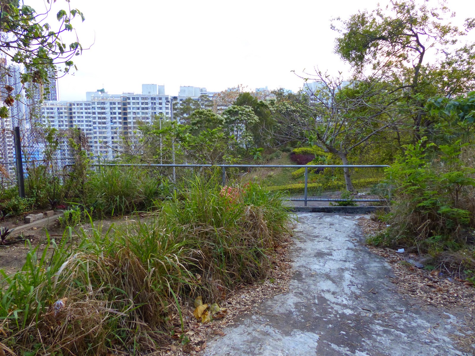
The railing marks the end of the road for curious passers-by (veggie patch on the left), but if you get a bit closer you can see where the road has just been hacked away (see below).


This lower picture above shows the area on the other side of Tai Po Road where the on/off ramp curved around to connect with the eastbound Tai Po Rd traffic. Although the flyover has gone, the small embankment that held it is still there but has been turned into a small plant display showing the Leisure and Cultural Services Dept (L.C.S.D) emblem - a sort of stylised Tai chi player. I've attached a Streetview picture of it below, as seen from the eastbound lane of Tai Po Rd. There's a small pathway just visible that goes around the back and I suspect this was created when they removed the road.

Another Streetview picture below shows us the remainder of the flyover base on the north side of the road. It was from up there that I took the pictures posted immediately above.

Source: HK Govt archives
That's Tai Po Road going from bottom left to centre right, and the curved on/off ramp is connecting Tai Po Road with the Lung Cheung Road (which is behind the camera).
Sometimes it's difficult to tell when infrastructure changes come about through necessity, or when they come about simply because the Govt hasn't got any ideas what to do with its massive capital reserves (sometimes it's very easy to tell with some great white elephants appearing: Cyberport, Kai Tak Cruise Terminal, HK/Zhuhai Bridge, etc) but whatever the reason, the interchange was surplus to requirements. It was replaced by one of the most convoluted lane systems I've ever come across and it seems that even taxi drivers get confused as to which lane they should be in order to end up at the correct destination!
Anyway, in typical HK fashion, only the most important bits of this interchange were removed (the flyover) and the rest has just been left to nature. I was curious to see what was still there so I wandered down the road to have a look-see. Here is a GoogleEarth picture showing the area in question.
The Chak On Estate is centre left, Tai Po Road coming up from centre bottom, and Lung Cheung Road curving across the upper part of the picture. I've marked it again below so you can see where the on/off ramp used to cross over Tai Po Road.
So the road system came down from Lung Cheung Road and hooked underneath the reservoir (that's the curved structure above the red line) before crossing over the Tai Po Road via the flyover and joining the eastbound traffic on that road. As mentioned the flyover was removed (sometime in the mid-1990's, I believe) but the section of road by the reservoir still exists even though it ends in a dead end. I walked down there the other day and took a few pictures. To be honest, it was hard to believe that only just 20 years ago, cars were still driving down here to join onto the Tai Po Road.
This is taken from the entrance to the road. You can see the edge of the covered reservoir on the right hand side.
The markings on the reservoir tell us when it was built. Like many other reservoirs in this area, it us underground, although several other nearby have had their top utilised for other things. An example is the nearby Shek Kip Mei Service Reservoir that has a park on top of it.
Carrying on further down the curve of the road the way narrows significantly. I'm not sure if this is due to the road surface being removed on the left of the fence, or whether it is due to the shotcreting of the reservoir slope on the right hand side. Possibly the former reason because Tai Po Road (seen below on the left hand side of the picture) has been widened significantly, and I am sure the embankment containing the road I was on was removed as part of the reconstruction.
Once we squeeze past the tight spot, the road returns to normal and as you can see up ahead on the picture above, the beginning of the left hand curve that can be seen in the lower part of the 1960's picture.
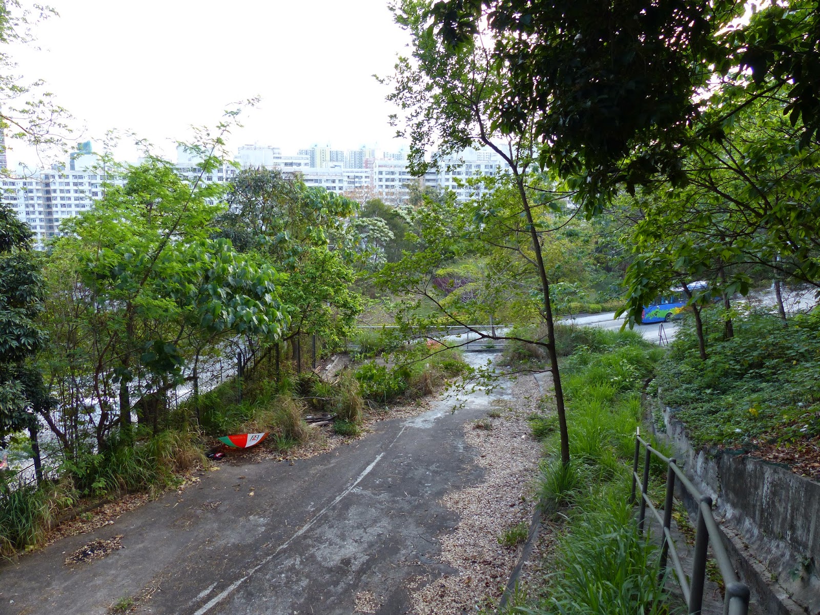
You can see part of the new road system up ahead - the flyover is the new part of Lung Cheung Road that now goes down to meet the Tai Po Road. The newer flyover is much straighter as it joins the other road, unlike the old interchange with its big slowing curve. These days people just zoom by.
Finally we get to the end of the road (quite literally in this case) as we get to the section where the flyover used to begin, but now is just an abrupt end.
The lower picture (above) I took by walking up the slope for a better view. I hadn't realised at the time that the road still had its centre lane markings on it. The small overgrown section (just past the umbrella) is where some enterprising person has created a small vegetable garden. Given the fact that no one comes down here anymore seems to make it the ideal location.
This lower picture above shows the area on the other side of Tai Po Road where the on/off ramp curved around to connect with the eastbound Tai Po Rd traffic. Although the flyover has gone, the small embankment that held it is still there but has been turned into a small plant display showing the Leisure and Cultural Services Dept (L.C.S.D) emblem - a sort of stylised Tai chi player. I've attached a Streetview picture of it below, as seen from the eastbound lane of Tai Po Rd. There's a small pathway just visible that goes around the back and I suspect this was created when they removed the road.
Another Streetview picture below shows us the remainder of the flyover base on the north side of the road. It was from up there that I took the pictures posted immediately above.


0 komentar:
Post a Comment
Note: Only a member of this blog may post a comment.