I had just finished reading Captain Penn's War Diary of No 1 Coy HKVDC which is held at the National Archives in Kew, England. The diary graphically describes the attack on the Coy's positions at Sanatorium Gap. Japanese troops landed on the night of 18/19th December 1941 and moved up Mount Parker Road fighting through the defensive positions at PB 45 and proceeding up the track and seizing Sanatorium Gap and the two high points on either side of the gap - Mount Parker and Mount Butler. With all this fresh in my mind and having returned to Hong Kong I decided to walk that route and to look at the positions at Sanatorium Gap referred to in the War Diary.
Read on and join me on this walk through history.
Sanatorium Gap is the saddle between Mt Butler (left) and Mt Parker (right) shown in the photograph below.
 |
| Sanatorium Gap - Mt Butler to the left (West) and the slopes of Mt Parker to the right (East) (Source: Writer's Collection) |
It was called Sanatorium Gap because a sanatorium or TB hospital known as Taikoo Sanatorium was built there by Butterfield & Swire the owners of Taikoo Sugar Refinery and Taikoo Dockyards situated on the north shore of the island immediately below the Gap. Geoff Douglass advises me that it was also used as summer accommodation for expat staff of Taikoo Dockyards and Taikoo Sugar Refinery. At one stage a ropeway/cable car system also provided access from Taikoo to the Gap. The Sanatorium was built in the 1890s and was demolished before World War 2.
The photograph below from 'Historical Photographs of China (Warren Swire Collection)' shows the Taikoo Sanatorium. In the background you can see the treeless slopes of Mt Parker, today this whole area is now heavily reforested.
 |
| Taikoo Sanatorium constructed c. 1890s (Source: Historical Photographs of China (web site) Warren Swire Collection) |
A slightly earlier photograph from the Hong Kong Museum of History shows the same building from the opposite direction and with the bare summit of Mt Butler as a back drop. Also in this later shot the centre section of the building has been added. Today the site of the building is a sitting-out and picnic area and in places you can still make out the ramparts of the original sanatorium. The army referred to it as San Gap. On the night of the 18th December it was defended by No 1 Platoon of No 1 Coy HKVDC. No 1 Coy was commanded by 42 year old Captain Arthur Harry Penn known as 'Harry' who in civilian life had been manager of a shipping company in Hong Kong.
 |
| Taikoo Sanatorium looking towards Mt. Butler (Source: Hong Kong Museum of History) |
Captain Harry Penn's Coy consisted of a Bren Gun Carrier Platoon (No 3 Pl) commanded by 2/Lt Edwards and stationed at Windy Gap near D'Aguilar Peak to protect the Shek-O area; No 1 Platoon commanded by 2/Lt Carter defending Sanatorium Gap (these days referred to as Quarry Gap) and No 2 Platoon commanded by 2/Lt Redman defending a low saddle to the north east of Repulse Bay then known as Repulse Bay View. In addition there was a Coy HQ Reserve based at Coy HQ situated initially at the PWD shelters and then later at the nearby Taitam Bungalow in Guage Basin to the south of the gap.
 |
| PWD Workmen's Accommodation - I think these were the PWD Shelters where Capt Penn first established Coy HQ (Writers Collection) |
 |
| Taitam Bungalow where Capt. Penn later moved his Coy HQ to and where his Telephone Exchange was situated. The building is now a ruin (Writers Collection) |
The night of 18th December was dark and the shore line below Sanatorium Gap was blanketed with thick black smoke emanating from burning fuel storage tanks at North Point which had been hit by shell fire. There had been very heavy shelling for the last few days on this stretch of the shore line. Under the cover of darkness and billowing smoke the Japanese invaded the Island of Hong Kong. They landed on what was called the North Shore on a front which stretched from North Point to Shau Kei Wan. Defending the North Shore was the 5th battalion of the 7th Rajput Regiment commanded by Lt. Col. Cadogan-Rawlinson. After fierce fighting the Rajputs were overran and the Japanese troops moved swiftly inland. A large number of Japanese soldiers proceeded from Taikoo Docks up Taikoo Path and towards the positions defended by 2/Lt Carter's No 1 Platoon.
No 1 Platoon was deployed defending PB 45 which was a Pill Box on the Taikoo Path near the junction with Sir Cecil's Ride and the Gap itself - roughly 25 men standing in the way of the Japanese army.
It was Monday 3rd November 2014, seventy three years after these events occurred that I got off the MTR (Mass Transit Railway) at Quarry Bay station and walked down Kings Road to the junction of Mt Parker Road (referred to as Taikoo Path in 1941). Its a metal road but closed off to vehicles. After climbing some way up the road I reached Woodside a redbrick building that was originally two buildings belonging to the senior managers of Taikoo Sugar Refinery which was situated just below. These houses were built pre-war.
 |
| Woodside (Writers Collection) |
 |
| Garages outside Woodside (Writers Collection) |
Continuing up the road I passed a service reservoir - again I'm not sure if this existed pre-war, I have not seen reference to it in war diaries. A little further up the road I passed a WW2 looking pump house.
 |
| WW 2 era Pump House or water tank (Writers Collection) |
Then a little further up and looking down the valley beside the road I had a surprise. Hidden in the undergrowth was a ruined WW2 splinter proof toilet - with all the shelling going on it must have been some comfort to have such protection when attending to the call of nature !
 |
| Remains of splinter proof toilet (Writers Collection) |
 |
| Some parts of the road are probably little changed since 1941 (Writers Collection) |
 |
| This telephone cable could be WW2 vintage (Writers Collection) |
 |
| The junction of Sir Cecil's Ride with Taikoo Path - the main force of Japanese troops turned eastwards towards Jardines Lookout here, the rest continuing up the hill to Sanatorium Gap (Writers Collection) |
 |
| A broad path leading eastwards (Writers Collection) |
 |
| Japanese troops on Sir Cecil's Ride some of whom seem to be carrying bungalore torpedoes. (Source: Taken from the signboard at the junction of psaths) |
 |
| A shelter just above the junction of paths - PB45 would have been nearby (Writers Collection) |
The War Diary for No 1 Coy HKVDC makes references to there being two shelters and to PB 45 being at the junction of Sir Cecil's Ride and Taikoo Path
"There were two shelters and only the upper one was manned."
Could this be the second shelter referred to in the diary - I think likely but of PB 45 there was no sign - so presumably demolished but why bother to demolish it - certainly I found no sign of it but perhaps it is still hidden from view.
"An attack in considerable force, but actual numbers unknown was made up the valley from Taikoo and although parties seemed to have side stepped PB 45, the enemy had decided they had to neutralize the PB 45 section in view of its position on the junction of the Sanatorium Gap path and Sir Cecil's Ride. The main party then followed Sir Cecil's Ride with Jardines Lookout and Wong Nei Chung Gap as their objective.
A second party continued up the valley by the main path and up the bed of the valley and up to Sanatorium Gap but prior to reaching the Gap they spread out fan-like . Having taken Sanatorium Gap the enemy proceeded to Mount Parker that being their objective".
 |
| The road up to Mt Parker and the track to Boa Vista on the right (Writers Collection) |
No 1 Platoon had been expecting reinforcements on the night of the landings in the form of a platoon from the Royal Rifles of Canada. This platoon was based on top of a feature called Boa Vista. They should have arrived along the path shown above. An NCO and two ORs (Other Ranks) were sent out from No 1 Platoon to meet them along the path and act as guides. The Canadian Platoon apparently went up Mt Parker instead of emerging at the Gap.
"The attack on Sanatorium Gap was over when our guides finally did connect with them. Had they reinforced us before the attack developed there would have been a reasonable prospect of holding the gap until daylight."
 |
| Sanatorium Gap today with the slopes of Mt Butler in the background (Writers Collection) |
The path up from Sanatorium Gap to the summit of Mt Butler is much steeper than it looks in the photograph above. Captain Penn had positioned an LMG section on the top of Mt Butler to guard the left flank. This position was attacked by Japanese soldiers who stealthily climbed the steep northern slopes of Mt Butler from a position on Taikoo Path below the Gap. They got close enough to make a rush on the position.
"There was only one survivor who was wounded and taken prisoner that night. The Sgt. and four ORs being killed on Mt Butler and one OR subsequently killed at Stanley. From this survivor I gather that they had barely got into position on Mt Butler. They were rushed almost without warning by a number of the enemy and wiped out in hand to hand fighting - mostly bayoneted. They did just get their gun into action and the survivor thinks they did inflict some casualties."
Shortly after the LMG section were overran on Mt Butler the Japanese assaulted the Gap.
"Just before 0100 three members of PB 45 Section came back to our position up the Taikoo Path two of them wounded. They reported the position had been attacked and overrun and they thought the enemy were close on their heels.
I was positioned approximately in the centre of the Gap with two Rajput ORs whom I had positioned one on either side of me. On my left was the main path with the LMG team 2/Lt Carter a few yards behind it with three or four of our own men. The two European Police and one or two Indians extended from the path in a line up the lower slopes of Mt Butler for 15-20 yards. On my right were the two MGs (Vickers Guns) and the rest of the force were extended in suitable firing positions as riflemen, with three men watching our rear flanks.
����.. a party was heard in front and a challenge brought no prompt answer and then a few unintelligible words. Someone on my left I think 2/Lt Carter shouted �Who the hell are you � answer or we fire�. The party appeared to be 50 or 75 yards in front on the main path. There were a few seconds of hesitation and then fire was opened by the LMG section and this was immediately taken up generally from our positions.
After probably some ten minutes, the enemy opened up with an LMG and more intense rifle fire. Simultaneously there developed a string of chattering or gabbled orders from the path a short distance ahead but I formed the opinion that the main attack was being developed up the valley to our right of the path and warned the MG sec to this effect. The intensification of enemy fire was apparently covering fire for a closer attack as a few minutes later all our positions were subjected to a heavy hand grenade attack from close quarters. The party making this attack had come up the bed of the valley and the grass-cutters path leading to our LMG positions and had got to within a few yards unobserved (I feel sure they were operating with guides who knew the ground perfectly - certain members of the platoon, both on PB 45 and San Gap positions, state that they saw differently dressed persons in the van of the attack). Fortunately many of the grenades proved to be duds or non-effective, otherwise this grenade shower would have inflicted heavier casualties than was the case. The LMG and 2 MGs were in continuous action all this time although handicapped by their inability to pick out specific targets (because of absence of very pistols). The grenade bombardment was immediately followed by an attempted rush on the centre of the Gap (my own immediate front) by a very small party of the enemy, but which was unsuccessful. At the same time a rush was made up the main path and the grass cutters path upon our LMG at the junction of these two paths. The LMG was kept firing by the No 1 until he and his No 2 were overran; one being bayoneted and the other shot at point blank range.
2/Lt Carter with those that remained of the party with him, on my left, took toll of this rush � one of the European Police and the Indians had slipped away earlier. At this stage I was dazed or very temporarily unconscious from a crack on my helmet from a grenade which burst immediately in front. On beginning to see things again a few seconds later, one of the two Rajputs with me was dead and the other had disappeared. An orange red flare (presumably a success signal) suddenly flared up on the site of the LMG position and in the light of this a small party of the enemy were gathered at the path junction and were wiped out with fire from my own and 2/Lt Carter�s position. Our MG section were now silent except for scattered rifle fire and I imagine that with the over running of the LMG, the enemy thought they had overcome effective opposition and consequently lit their success signal, as the wiping out of that party was followed by a lull for around 10 minutes.
From subsequent comparisons with 2/Lt Carter it appears that of his party only himself and one European Police Sgt. were left and they made their way round o the MG Section to find out the position there and the reason for the cessation of fire � passing to my left and behind me. I remained in my own position unaware that 2/Lt Carter�s position was now �no-est� and expecting any further enemy rush would again be met with fire from them and the MG section. It transpires that having made his way round to the MG Sec, the Police Sgt disappeared and 2/Lt Carter found the Sec Cdr (Sgt Murphy) and three members of the section left � two of them wounded and pulling their guns out. The section commander had concluded that the rest of our defence was wiped out and decided that with the inadequate gun teams, he could not remain effectively in action and he would pull his guns out.
2/Lt Carter concurred in the decision to withdraw, his main thought being to get word to the HKSRA Batteries at Tytam, as he was of the opinion that the enemy had penetrated over the slopes of Butler and Mt Parker. The party consisting of 2/Lt Carter and four ORs (convinced that they were the only survivors) made their way along the Boa Vista path (shown in the photograph above) and thence down the Tytam Path.
Meanwhile I was waiting unaware of these developments, in my original position until the �lull� referred to earlier was broken by a sudden rush of a number of the enemy (probably 12 to 18) from the path on my left front, immediately past and behind me to the shelters. For the reasons stated there was no fire from our positions and I personally �lay doggo� and was passed unnoticed. Within a few minutes I was able to make my way unobserved across the few yards back to the head of the path down to Tytam. The enemy party which broke across the gap, seemed to make their way across our shelters and up the slopes of Mt Parker."
 |
| The head of the path on the reverse slope leading down to Taitam X-Roads (Writers Collection) |
The path running south from the Gap was the main extrication route. The photo above was taken from the top of the path near the Gap facing south, with the slopes of Mt Cameron to the right (west) and looking down towards the first bend which is a sharp hairpin bend as seen in the photo below. It was down this path no doubt close to the hairpin bend (below) that Captain Pen withdrew to make his appreciation.
 |
| The first bend - about 75 yards below the Gap (Writers Collection) |
"About 30 yards down the Tytam Path I connected up with my MC (motor cycle) Orderly and a wounded member of the Platoon and shortly afterwards another of our ORs joined us from over the right shoulder of Butler. The wounded man was sent on down and ordered to hurry the CSM�s HQ party whilst I decided to wait where we were and await the arrival of the CSM�s party. At this stage I also thought that our small party represented the sole survivors. We waited there for some 15 minutes during which time the enemy could be heard round the corner in the Gap and above us on Butler and as there was still no sign of the HQ party I decided to continue on down the path until we met them and then consider some plan of utilizing them in retaking the Gap."
It turned out that the CSM's party had left for the Gap but on the way up had been told by Indian (Rajput) stragglers from the fighting on the North Shore and by walking wounded extricating up the path from Taikoo and over the gap and down the path to Taitam shown in the photograph above, that the position at the Gap had been over-run. The CSM decided therefore to fall back to Coy HQ the PWD Shelters near to Taitam Bungalow and to hold that position.
Captain Penn later connected with 2/Lt Carter and his party who had extricated down the Boa Vista Path on the Taitam side of the junction of two paths.
Later that morning on 19th December at around 0700 Captain Penn moved his Coy HQ to Taitam Bungalow from the adjacent PWD Shelters:
"I moved my Coy HQ from PWD Shelters to Taitam Bungalow, the latter being the best observation point in the vicinity and my telephone exchange being there."
Just about the time I did this walk the telephone exchange or field telephone was found at Taitam Bungalow by military history enthusiast Dave Willott - it had been discarded down a slope and is shown in the photograph below only the phone (ear and mouth piece) was missing from its cradle. The set was made from bakelite an early form of plastic which explains why it looks in such good condition after all these years.
 |
| Recently found Field Telephone set from Coy HQ at Taitam Bungalow - still looking good after 73 years ! (Courtesy: Dave Willott) |
 |
| A look inside - it would be hard to make a call now ! (Courtesy: Dave Willott) |
How incredible to find this - at least one other has been found but smashed up before being abandoned on a battlefield. I'm surprised No 1 Coy did not disconnect it and bring it with them when the Coy HQ and what was left of No 1 Platoon extricated in their vehicles down to Taitam X-Roads and then on to Stanley later that morning.
"We then destroyed our telephone communication and immediately afterwards a runner (L/Cpl. Gaubert) came up from our positions around the HKSRA Bty. with a message from the CSM that all troops were ordered to Stanley as soon as possible. I ordered all weapons and equipment to be loaded into our transport and troops then to on-truck."
The telephones had been a continual problem - there was a direct line to No 2 Platoon at Repulse Bay View - this was the only working line. This platoon was under operational orders of Winnipeg Grenadiers. It was impossible to get through to No 1 Platoon at the Gap and required going through other unit exchanges as Platoon 1 was under operational orders of 5/7 Rajputs. The line from Sanatorium Gap to PB 45 did not function either. As a consequence communication in the Coy areas was difficult and had to be maintained by motor cycle orderly and runners.
Back to the future and I'm walking down the same path that Captain Penn had withdrawn down from the Gap with what was left of No 1 platoon and the impressed defenders from other units (including police and Rajputs).
Further down the path I came to a junction of two paths which must have been where Captain Penn met up with 2/Lt Carter's party. One path leading off to the left and uphill. At this junction there was access through a flight of steps to a hill top overlooking the upper reservoir. I had been up here before with fellow military history enthusiasts Craig Mitchell and Martin Dewick. I passed a large man-made cave with tunnels leading off right and left.
 |
| I assume a Japanese tunnel some 20 or 30 metres below the summit of a hill top overlooking the upper reservoir in Guage Basin (Writers Collection) |
The slope bhind the tunnel is steep and leads to a military shelter on or rather close to the summit.
 |
| A WW2 military splinter proof shelter on the hilltop (Writers Collection) |
The last time I was here with Craig and Martin we had found Japanese spent rifle rounds on the slope leading to the shelter. Presumably these were fired on 19th December when the Japanese were infiltrating into Guage Basin. Whether or not this hilltop and shelter was manned I don't know. The shelter would have housed a section and having a prominent command over the reservoirs may well have been defended by an MMG team.
A look inside the pillbox (see below) showed the usual hooks by the door (wall to left of door) presumably for hanging coats and helmets etc and rather large fittings on the wall to right of door which would have been used as makeshift bunks. I believe the beds that hooked on to these latches could be used as stretchers too and presumably were stretchers doubling up as bunk beds. A shelter like this could accommodate a section of some 6 men. There is a ventilation shaft in the roof and the door and window shutters were made from reinforced iron which would stop bullets or bomb splinters.
 |
| Inside the shelter - with usual stretcher/bed fittings and hanging hooks by the door (Writers Collection) |
 |
| A view through the door showing the bunk/stretcher fittings (Writers Collection) |
 |
| A view of the opposite wall (Writers Collection) |
I am yet to discover the name of this hill feature (perhaps a reader can help). There's a good view from the crest of the hill looking directly down on the dam across the reservoir.
 |
| The view from the crest of the feature where the military shelter was (Writers Collection) |
I crossed the dam shown in the photograph above and followed the path round to the left which leads down towards the Taitam X-Roads. Another path leads up to what is now Park View but was then known as Stanley Gap Road and led from Guage Basin to Wong Nei Chung Gap.
Having turned left at the dam, after a while the path splits in two - one being Mt Parker Road - the other being Taitam Reservoir Road but they join together further down. I chose Taitam Reservoir Road as it seemed the one that was most commonly used and the more natural route and by this time lunch was beckoning. I passed on my right a rather ugly looking military structure that I have passed many times before. Its in a rather exposed place which is now a barbecue area. It was not a PB as there was no observation tower or firing apertures. It would been camouflaged with netting and foliage back in WW2.
 |
| A military structure in Guage Basin now part of a barbecue area (Writers Collection) |
There were two ventilation shafts and an unusually wide door and window which had been sealed up. The window would have had heavy iron shutters and the door would have been made of heavy wrought iron. I wondered what it was, again perhaps a reader might know. It may have been an Advanced Field Dressing (ADS) station or perhaps kitchen shelters or storage for ammunition for the nearby HKSRA Howitzer Battery.
 |
| The military structure had a rather wide door and window which had been concreted up (Writers Collection) |
Off to the left hand side of the road only about 50 or 75 yards away was another pre-war building. This had been as an accommodation building for Public Works Department (PWD) employees. There is another similar building close to the ruins of Taitam Bungalow.
 |
| PWD Workers Accommodation (Writers Collection) |
 |
| PWD Workers Accommodation building (Writers Collection) |
As I walked down past the building above I was glancing up the hillside to my left when I saw what I thought was a structure. Straight lines but it was hard to see through the foliage. I clambered up the slope and found to my surprise a military structure that I never knew existed. Here it is below:
 |
| I stumbled across this military structure on a knoll beside the path (Writers Collection) |
It had three ventilation shafts and as I walked round to the front I found out why. It was what soldiers call the "shit house" ! It was a bomb or rather splinter proof toilet.
 |
| Soldiers toilets side by side (Writers Collection) |
 |
| Officer's or senior NCO's (individual) toilet (Writers Collection) |
 |
| No mistake what this is (Writers Collection) |
 |
| Traces of camouflage paint still left on the splinter proof toilets (Writers Collection) |
Where there is a military toilet there must be other structures so I fought my way through the undergrowth to the crest of the hill which lies between Mt Parker Road on the left and Tai Tam Reservoir Road on the right. I soon came across several small concrete structures which looked like the storage structures for ammunition that one sees at some gun emplacements.
 |
| Ammunition storage lockers (Writers Collection) |
 |
| Storage locker for ammunition suggesting a Battery position (there may have been iron doors since removed) (Writers Collection) |
 |
| Mimi Lau breeze blocks such as these were much used in WW2 |
Breeze blocks with hollow centers known in 1941 as "Mimi Lau" (for explanation see my blog on Wing Commander Steele-Perkins and the ARP scandal) had been used to make retaining walls around a flat concrete base. Could this be a gun position.
At the crest there was a military shelter but somebody had put a screen across the window. It looked like somebody had been living in it.
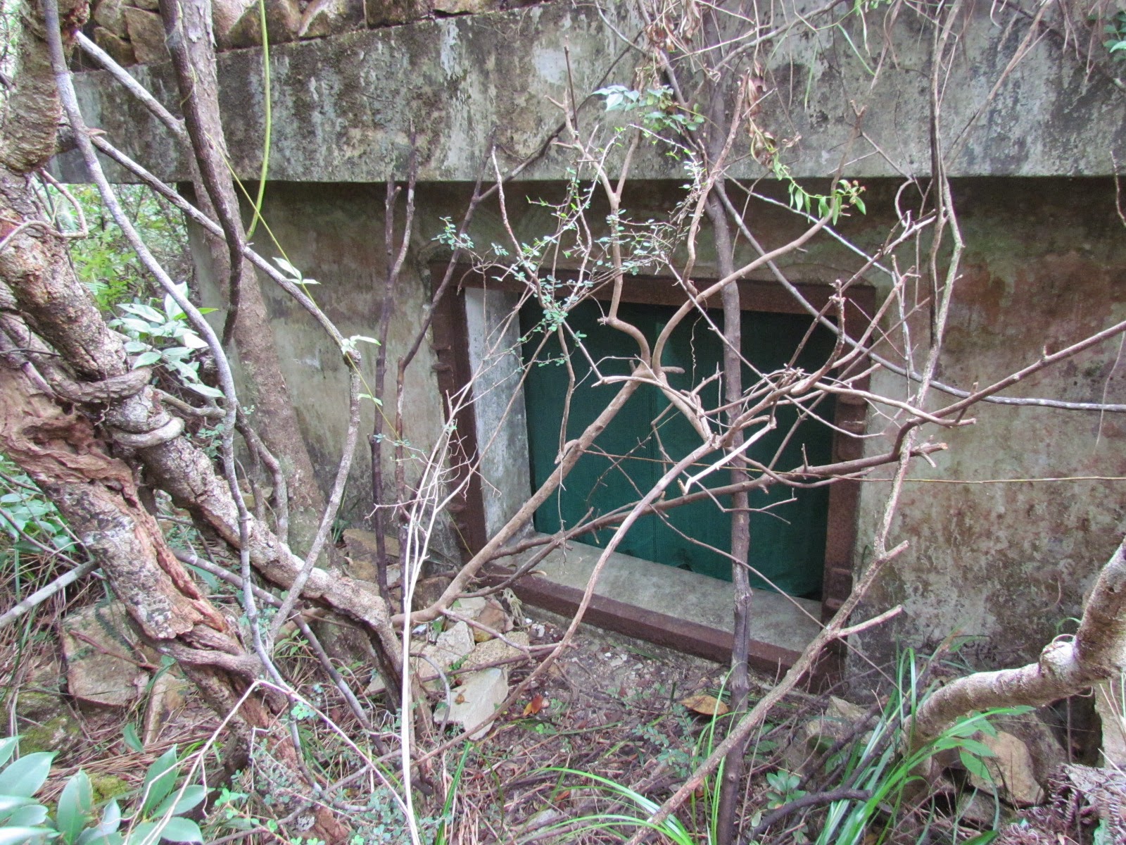 |
| A green screen placed across the window of the structure (Writers Collection) |
What sort of person would live in a WW2 shelter like this ? I pulled aside the green mesh screen and peered into the interior, it looked like a hammock had been strung up and there was something on it - or was it somebody. I had that sense of trespass like I was intruding on someone else's domain and anyway discretion took the better part of valour and I decided not to go inside, and of course lunch was still beckoning.
I then somewhat stumbled on a flight of steps which led down a short distance to Mt Parker Road and strung out either side of the steps were not one but a whole string of military shelters.
 |
| A flight of steps leading to the hill top shelter and military toilets (Writers Collection) |
 |
| A string of shelters on either side of the steps (Writers Collection) |
 |
| The shelters seen from the Mt Parker Road (Writers Collection) |
 |
| Looking towards the hill top feature (previously referred to) from the shelters on Mt Parker Road with the summit of Mt Butler in the distance (Writers Collection) These shelters given the number of structures would have been occupied by a Coy or a Battery. Rob Weir an expert on Fixed Defences advised me that this was the Hong Kong Singapore-Royal Artillery (HKS-RA) battery known as Taitam Fork Bty and they had one 3.7 inch Howitzer. This may have been positioned on the concrete area near the uppermost shelter which is surrounded by low retainer walls made of Mimi Lau blocks. The following week I went back with a metal detector and picked up a surprise find - it was a brass shoulder flash with the words S-RA (the HK being broken off). See the photograph below. This find confirmed the supposition that this was an HKSRA Battery position.  I carried on down the road to the lower reservoir. The photograph below shows the road and the summit of Bridge Hill in the background. On 21st December Brigadier Wallis commanding East Infantry Brigade launched a battalion level counter offensive made up of Royal Rifles of Canada and No 1 Coy HKDVDC. These units moved out at dawn from their positions at Palm Villa their first objective was to seize the Taitam X-Roads and then turn left up this very road leading into Guage Basin also known as Taitam Valley and to drive up past the reservoirs and re-take Wong Nei Chung Gap. This was a bold move but never really stood a chance as the Japanese were now on the Island in huge numbers. The attack had no artillery support and the units had few mortars which would have helped clear Japanese from Bridge Hill (see photograph below), Red Hill and their MG positions in the area of the X-Roads. |
 |
| Taitam Reservoir Road leading to Taitam X-Roads with the Summit of Bridge Hill in the background This counter attack failed. They had managed to seize the high ground on the left, Notting Hill and Bridge Hill and they had been able to get right up to the X-Roads but they had not been able to clear the Japanese from Red Hill on the right flank nor the Japanese machine gun positions at the X-Roads. Heavy casualties were incurred and Captain Harry Penn was shot in the face whilst trying to clear Red Hill of Japanese troops. |
As I walk towards the X-Roads I pass a group of sealed up military shelters. They have the typical features of one narrow heavy iron door and a window with heavy iron shutters. These shelters had been concreted up and the area in front of them had been converted into a picnic area. Judging by the number of shelters this would have been occupied by an infantry company or by a mobile battery.
 |
| Military shelters at Tytam Tuk Reservoir (near the Tytam X-Roads) |
On the day I did this walk. A lorry (the orange lorry in the photo below) had got stuck on the narrow road bridge over the top of the dam, this is a common occurrence - there is not enough room for two buses or two heavy lorries to pass each other. Above the road you can see the lower slopes of Mt Parker. On the other side of this bridge you can see the road heading up the small hill before it turns right and runs towards Taitam Gap.
 |
| The road bridge across the dam - the road continues up to the Taitam Gap where East Infantry Brigade and Royal Rifles of Canada had their brigade and battalion HQ respectively |
 |
| The TaiTam X-Roads with Mount Parker dominating the skyline - the end of the walk. (Writers Collection) |
The Taitam X-Roads shown above was the end of my walk. After the failed counter attack on 21st December the X-Roads remained in enemy hands. Captain Penn was taken to St. Stephens Temporary Hospital in the grounds of St Stephens College then known as the "Eton of the East". He discharged himself on 24th December which was just as well as the following the day the Japanese broke into the hospital and bayoneted patients in their beds in an orgy of violence that still beggars belief.
Captain Penn was repatriated to England in December 1945 returning to Hong Kong in 1946 to resume his job with the Bank Line, a shipping company he had worked for before the war. He passed away in April 1972 at the age of 73.
������������..
Sources & Acknowledgements
(1) All quotes in italics are taken from the War Diary of No 1 Coy HKVDC written by Captain
Harry Penn.
(2) Thanks to Military History enthusiast Dave Willmott for permission to use photographs of Field
Telephone set.
(3) Thanks to Geoff Douglass for information pertaining to the Taikoo Sanatorium
(4) Thanks to Rob Weir for information on HKSRA Gun Batteries in the Taitam Valley/Guage Basin
area.


0 komentar:
Post a Comment
Note: Only a member of this blog may post a comment.